Better maps, better science
Better maps, better science McGill University
User Tools (skip):

Better maps, better science
Ecoregion maps aid disease prevention, marine conservation
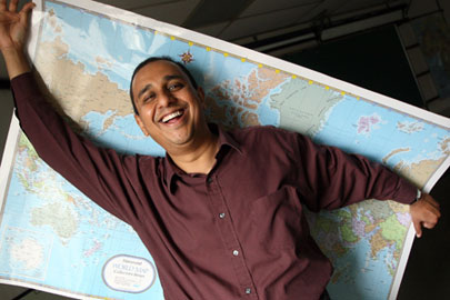
For his research on Avian Flu, Geography professor Raja Sengupta used a significantly more advanced form of mapping than the one he's holding above.
Owen Egan
What do seahorses and birds carrying the Avian Influenza virus have in common? For starters, neither of them needs a passport to move around. If it were easier to track the whereabouts of wildlife, we would be better equipped to protect them—or ourselves, as the case may be.
That is the rationale behind the simple-yet-powerful tool of mapping. Maps and Geographic Information Science (GIS) can be used to visualize and analyze data in countless ways, for example, the regional concentration of living organisms and their proximity to specific human activities or natural environments. And today, mapping is more powerful than ever.
"The availability of data is exploding, and it's not just because of Google," says Dr. Raja Sengupta, a professor in the Department of Geography and the McGill School of Environment. "Input from satellites and other sensing technologies covering the planet is driving better mapping techniques. We can study the whole world at very fine spatial resolution with rich information about climate, elevation, human population, land use, land cover—the list keeps growing."
It was the abundance of geographic data that enabled the creation of "ecoregions," a classification system made up of large units of area across the earth. Each ecoregion is shaped by assemblages of natural communities and determined by climate, geology, and historic evolution, to list only a few factors. On land and on water, ecoregions have proven valuable keystones in two studies by McGill researchers. Migratory birds carrying Bird Flu are causing panic (below), and marine biodiversity threatened by human activity is also raising concern (see sidebar, below).
Mapping the source of Avian Influenza
The highly pathogenic avian influenza (HPAI) subtype H5N1, more commonly known as bird flu, has caused outbreaks and resulted in human deaths across Europe, Asia, and Africa. Before preventative measures can be proposed, the significant sources of bird flu must be identified. Dr. Raja Sengupta used a simple mapping technique to test a creative hypothesis. The findings may hold the key to containing a global epidemic.
In an article published in the August issue of Emerging Infectious Diseases, Dr. Sengupta and the student co-authors investigated whether or not specific ecoregions have a significant concentration of disease outbreaks. Among their findings, one striking result was that 76.8 percent of all outbreaks occurred in only 25 ecoregions—just 8.8 percent of possible areas. By their very design, ecoregions contain nesting and breeding habitats for carriers of the disease. High concentrations of outbreaks suggest priority monitoring areas for health officials.
Once the hypothesis was formulated, the legwork behind the study was remarkably easy, says Sengupta. Data on the locations of 3,133 avian influenza outbreaks from November 24, 2003 to November 21, 2006 was obtained at no cost. The 825 ecoregions boundaries set by the World Wildlife Fund are also freely available.
"Anyone with two introductory courses in GIS could have done this work, and yet it was considered important enough to be accepted in a professional journal," says Sengupta. "High-quality data is now available for an untold number of worthwhile studies."
Analysis in previous studies suggested that bird migration pathways may explain the source of the outbreaks, but Sengupta argues that pathways have only nominal reference to climate and vegetation along the way, factors that control migration. Other researchers have commented on the findings, arguing that while regular bird migration and movement was initially responsible, unrecorded or illegal poultry trading has become the primary cause of new outbreaks. Were this the case, counters Sengupta, regions in Mongolia would not have such low incidence compared to neighboring China and south-eastern Russia. Though the debate is not settled, it is clear that mapping and GIS ought to be among the first tools in analyzing the source of Bird Flu.
Meanwhile, the World Health Organization has only produced country-by-country maps. Sengupta explains that political maps such as these are presented with no analysis or commentary, and with no understanding of the causal factors behind bird flu. Devoid of ecological concepts, a country map is relatively useless for proposing preventative measures.
"One would think that the WHO is using every resource available to come up with a solution, but they simply are not. Diseases are not merely political issues."
Sengupta recognizes that ecoregions are still a coarse concept. The large area contains many interruptions in habitats favorable to birds. As in many studies using maps, on-site surveys are a necessary complement for boosting confidence. Increases surveillance in the right areas would help answer any doubt about unreported cases and effects of the poultry trade.