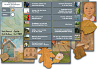
West Island atlas
When a lot of Montrealers think West Island they think suburb. So why did geography professor Thom Meredith bother making an environmental atlas of the area? Call it a civic duty.
"There's a new sense that there is a responsibility for citizens to take a more active role in environmental stewardship," explained Meredith, editor of the atlas.

That responsibility requires information, and it was for this reason that the McGill University Project on Community Based Environmental Decision Support (CBED) was started. In the pre-merger days, the West Island was under the purview of several small municipalities. With suburban development putting ever-greater pressure on the area, coordinated action to protect the West Island's unique ecology was needed.
The West Island is unique in many ways. Few suburban areas adjacent to a city the size of Montreal have the open fields, farmlands and shorelines that one finds in the lands beyond NDG. In addition, the West Island lies at the confluence of the Ottawa and St. Lawrence Rivers.
"We're perched on an archipelago — nobody thinks of themselves as living on one, and the word itself has an exotic flavour," said Meredith.
The islands of the archipelago are nourished by two rivers, and vary in size and scope from Montreal itself to humps of land that are submerged entirely during high water seasons.
Meredith said The Environmental Atlas of the West Island was needed because as Montreal expands, priceless natural resources risk being transformed into housing developments. Although the spread of development in the area since the '50s has been dramatic, the West Island retains a remarkable amount of green space in the form of wetlands, forests and agricultural land. Very little of this is protected, and Meredith said that he expects much of it to be turned into more suburbs and industrial parks in the coming years — unless something is done.
To aid in explaining the situation to the public, Meredith said that the atlas will be distributed to local schools and libraries. The full text of the book would be an inch and a half thick — the print version is a manageable 30 pages.
"We tried to stress a mix of the ecological and human dimensions," said Meredith.
Contained within the atlas are sections on land use, geology, forests, wetlands and agriculture among other subjects, illustrated with full-colour maps.
Meredith said that the atlas was a collaboration of many interested parties with converging interests. David Brown of the school of Urban Planning and Avi Friedman of the School of Architecture both participated, along with several students. In addition, experts from the communities of the area and from Macdonald Campus all had input. The many-cooks approach was deliberate, said Meredith. Too often, when it comes to issues relating to the environment, communities are presented with information in a top down manner.
"Very often the information provided is not what people need or want," he said.
The full text of the atlas is also available online. Many of the maps are interactive — a map showing the progression of development from the '30s to today graphically demonstrates the spread of human activity over the previously uninhabited area.
Although Meredith said the purpose of the atlas and the accompanying website is to inform, he hopes readers will not stop there.
"I would hope that it's not an endpoint, but a beginning point," he said.
"I hope that it encourages people to think a bit more about that space they are in."
The Environmental Atlas of the West Island is available online at cbed.geog.mcgill.ca.
